
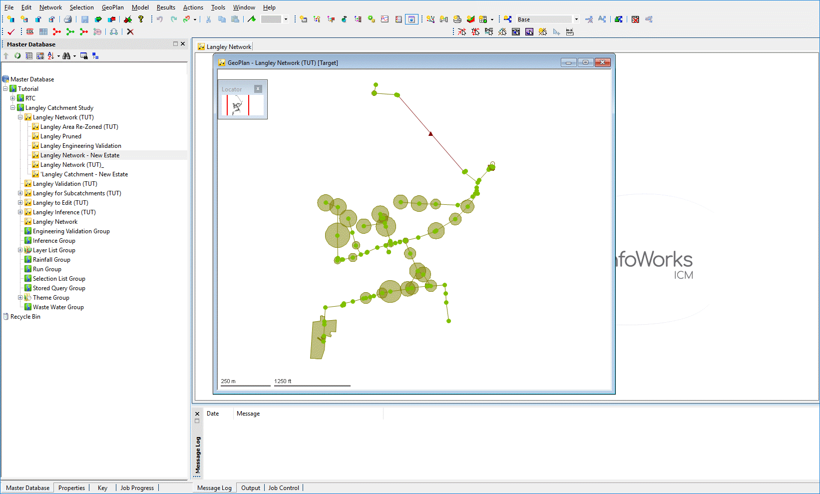
This stage assumes that you have started InfoWorks ICM and that the Master database, containing the ICM Basic Tutorial, is opened in the Explorer window, showing the 'Langley Catchment Study' model group.
The GeoPlan view is used to display a geographical representation of the network and allows the display of additional layers or map information. The size of the GeoPlan window can be adjusted by dragging the edges or by maximising the window.
The view is displayed when a network is opened (either by right-clicking the network in the Explorer window and selecting Open from the pop-up menu, or by dragging the network icon into the InfoWorks ICM main window.
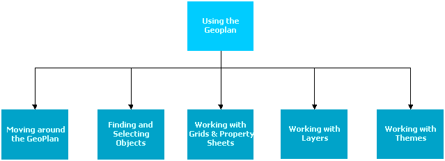
The following flowchart outlines some of the commonly used functionality available in the GeoPlan. The flowchart is selectable so you can click a rectangle to open the topic, which contains further information about the tasks. Selectable rectangles are displayed in a darker blue than the non-selectable ones.
 Back to main flowchart
